
The Algarve, Portugal’s southernmost region, is framed by a 200km coastline and boasts more than 300 days of sun per year. Home to award-winning beaches and authentic gastronomy, the Algarve’s 16 municipalities also offer a range of outdoor activities including surfing, cycling, walking and hiking.
Blessed with a stunning coasts, as well as hilly and softly contoured mainland, this part of Portugal offers fantastic trails to suit all ages. From family-friendly strolls to more challenging routes, here’s some of the best hikes and walks you can enjoy when on a trip to the Algarve.
Cape St. Vincent (Cabo de São Vicente)
This is the most southwestern point of continental Europe and is a significant landmark with striking cliffs and an iconic lighthouse, which has existed on the Cape since 1520. Arriving at Cabo de São Vicente you can imagine yourself in the shoes of the pilgrims who used to finish their journey at the burial place of St Vincent. From there, hikers can either walk from the Cape all the way to Sagres, or to Vila do Bispo and follow the Fishermen’s Trail, a part of the Rota Vicentina network that connects Cape St. Vincent with both towns. Sagres is 6km away, while Vila do Bispo is 10km away. For ease, the trail is marked with blue and green stripes on wooden poles and rocks.
- Duration: Cape St. Vincent to Sagres 1hr 30mins; Cape St. Vincent to Vila do Bispo 2hrs 30mins
- Challenge level: moderate
- Cabo de São Vicente details: visitalgarve.pt

Seven Hanging Valleys Trail
The Seven Hanging Valleys Trail is considered as one of the most beautiful hikes in Europe and has long been the most famous and popular of the Algarve hikes, encompassing some of the region’s most stunning scenery. The trail passes through limestone cliffs, offers spectacular sea views, and leads walkers to hidden beaches and natural arches. This 5.7km route connects Praia da Marinha to Praia de Vale Centeanes. Although you can begin from either end, it’s more common to start at Praia da Marinha and head west.
- Duration: this hike takes an average of 3hrs 30mins to complete
- Level: generally considered a moderately challenging route
- Trail details: visitalgarve.pt
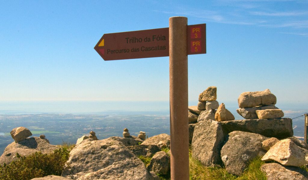
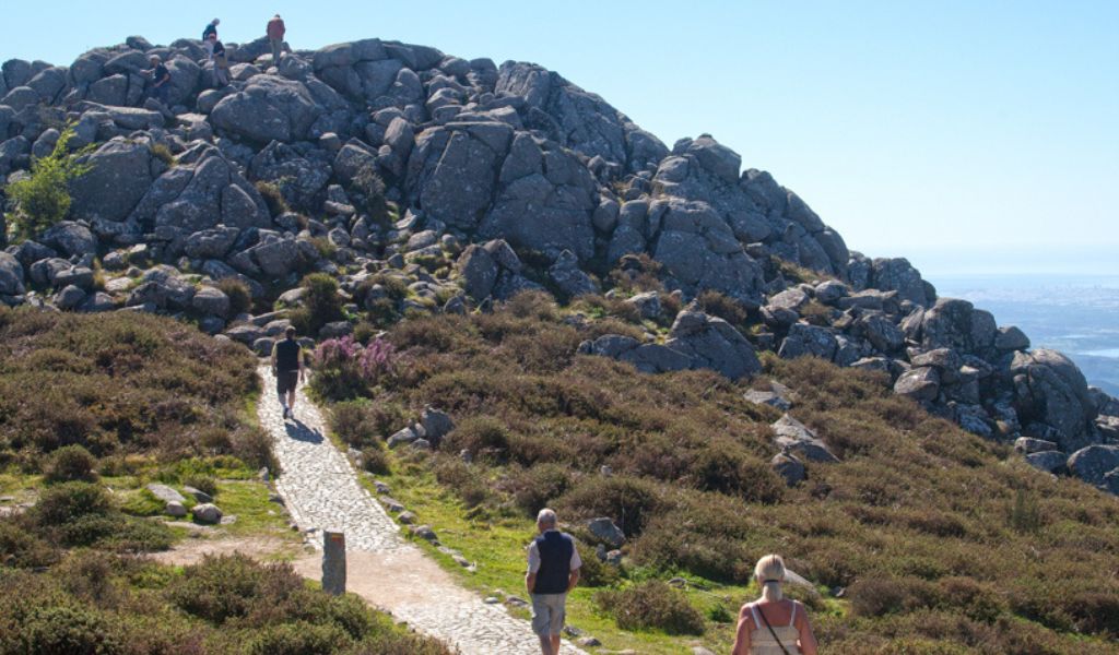
Fóia trail, Monchique
One of the big draws to Serra de Monchique is the nearby mountain peak of Fóia, and at 902m high, it’s the highest point of the Algarve. From the top you can see incredible views of the Algarve coastline including Portimão and Lagos to the south, and Cabo de São Vicente on the west. Discover the richness of the mountain, forest, water and pure air of the Algarve with a guided hike by Algarvian Roots. Depending on which option you chose, this guided trek also includes an experience on a potter’s wheel, a visit to an olive mill with olive oil tasting, and a soap workshop.
- Duration: 8hrs
- Challenge level: moderate
- Price: from €145/£123 per person depending on which additional activities are chosen
- Book: algarvianroots.com
- Trail details: visitalgarve.pt
Ria Formosa Natural Park
Covering more than 18,000 hectares, this is a series of saltwater lagoons and islands. It’s a haven for bird watchers, where you can see flamingos and other migratory birds. There are various walking paths, allowing you to choose a route that suits your pace. The São Lourenço Walking Trail is about three hours long, and is perfect due to its different habitats: marshland, scrubland, and freshwater lakes. Meanwhile, the Marim Centre of Environmental Education Walking Trail, located in Olhão, can take up to two hours and is ideal for families as not only is it easy to do but also covers all the habitats that can be found in the Ria Formosa Nature Park as well as Roman ruins and a tide mill.
- Duration: São Lourenço Walking Trail 3hrs; Marim Centre of Environmental Education Walking Trail 2hrs
- Challenge level: both moderate
- Ria Formosa Natural Park details: visitalgarve.pt
Fonte da Benémola Nature Reserve
Fonte da Benémola is one of the lesser known natural springs. Surrounded by 400 hectares of land, the protected area nearby is fed by the waters of the Ribeira da Menalva, enriching an important ecological system and supporting a large diversity of flora and fauna. The Fonte da Benémola walk is easy 2.5-mile circular track in the Loulé municipality and makes for a picture-perfect day out with the family.
- Duration: up to 2hrs
- Challenge level: easy
- Trail details: visitalgarve.pt
Via Algarviana trail
The north-eastern part of the Algarve is less frequented by visitors, but offers a unique blend of rolling hills, traditional villages and untouched natural beauty. The Via Algarviana hike spans the entire region from Alcoutim, near the Spanish border, all the way to Cape St. Vincent on the western coast – approximately 300km in length. However, if you’re specifically interested in the north-eastern section, you can walk from Alcoutim to Balurcos, and experience views of the Guadiana River, cork oak forests, traditional villages, and rich flora and fauna.
- Duration: Around 1hr 45mins
- Challenge level: moderate
- Trail details: viaalgarviana.org and visitalgarve.pt
A window to the Guadiana
This trail begins in Azinhal, a typical village in the Baixo Guadiana, Eastern Algarve, and ends at Várzea das Almas. Along this route, trekkers will experience views of the Guadiana River, can stop at the towns and their traditional architecture, and see incredible scenery such as wetlands, dryland orchards of almond and carob trees and hills covered in cistus, gorse and lavender. Along the riverbank, the salt marches take over the wide wetlands, and, looking south, walkers will be wowed with the bridge connecting Portugal and Spain, near the mouth of the Guadiana.
- Duration: 2hrs 30mins on average to complete
- Challenge level: moderate
- Route details: visitalgarve.pt
Images: Visit Algarve